Hagley District 8000BC – 50AD
Hagley lies to the west of the Clent Hills and most of its surface water joins the river Stour at Broadwaters, Kidderminster. Its highest point is 225m (740ft) and its lowest is 70m (230ft) above mean sea level.
For the purpose of these notes, the boundaries of the manor and parish of Hagley appear to be unchanged from Domesday until 1933 when Blakedown was taken from Hagley and added to the parish of Churchill. Therefore it is proposed to use the pre-1933 boundaries as all historical documentation relating to land will be based on them. These boundaries enclosed some 970ha (2,400 acres).
The geology of the area is mixed and includes a range of sandstones (olive, buff, red and brown), clay, pebble bands and light sandy soils. Much of the present day shape of the landscape can be attributed to the last glacial period, which ended about 8,300 BC Examples of the more prominent glacial features include Round Hill, south west of Wychbury and similar small hills to the west of Palmers Hill.
Water for drinking purposes rises mainly at a spring line around 210m (700ft) which accounts for Hagley’s early population being at the east end of the parish. The name of Spout Farm, which used to be opposite the end of Newfield Road, indicates the site of a spring. There is also another spring which rises near the bottom of Chapel Street. Water lay fairly near the surface in Church Street, Chapel Street and the neighbouring part of Worcester Road, if the number of pumps shown on the 1902 O.S. map is any guide.
The pre-history of Hagley and District
Before discussing the evidence that is available from the end of the last ice age through to the Roman invasion, it may help readers if the terms currently used to cover the major periods of human activity are defined.
The periods are:-
| Mesolithic (middle stone age) | 8000 – 3800 BC |
| Neolithic (new stone age) | 4200 – 2300 BC |
| Bronze age | 2400 – 700 BC |
| Iron age | 800 BC – 50 AD |
From the dates above it can be seen that there was never a clear cutoff point for any of the periods. Different ways of obtaining a living, by different races of people who took time to integrate, were some of the causes of this overlapping.
The earliest post-glacial way of life was based on a hunter-gatherer economy. Small bands of people worked over a fairly large territory for an annual cycle, killing animals and collecting fruits etc. The Nunamiut Eskimos and the Kung San of the Kalahari desert are still practising this way of life. This life style does not leave a great deal of archaeological evidence and when the subsequent activities of the last 6,000 years are taken into account, very little remains. To find any settlement of a temporary nature is a rare event and only a handful have been located in Britain, Starr Carr¹, in Yorkshire being one of the best examples.
The evidence in Hagley and district is based on very large numbers of flints, flaked to create a wide range of cutting tools such as adzes, scrapers, awls, points and microliths. The latter were used as saw teeth or sickle edges when bound and fixed into a wood or bone frame.
The area where many of these flints have been found lies to the south west of Cradley and north of Wassell Grove, and a large collection is being assessed by Birmingham University at present.
Little can be deduced from the large quantity of flint finds except to say that they indicate much activity, presumably over a long period of time and that some of the band must have travelled at least 60 miles to obtain good flint nodules.
The periods following the Mesolithic had a lifestyle based on farming and therefore the people were essentially static, living in small settlements adjacent to their cultivated land although their grazing land could be some way from the settlement.
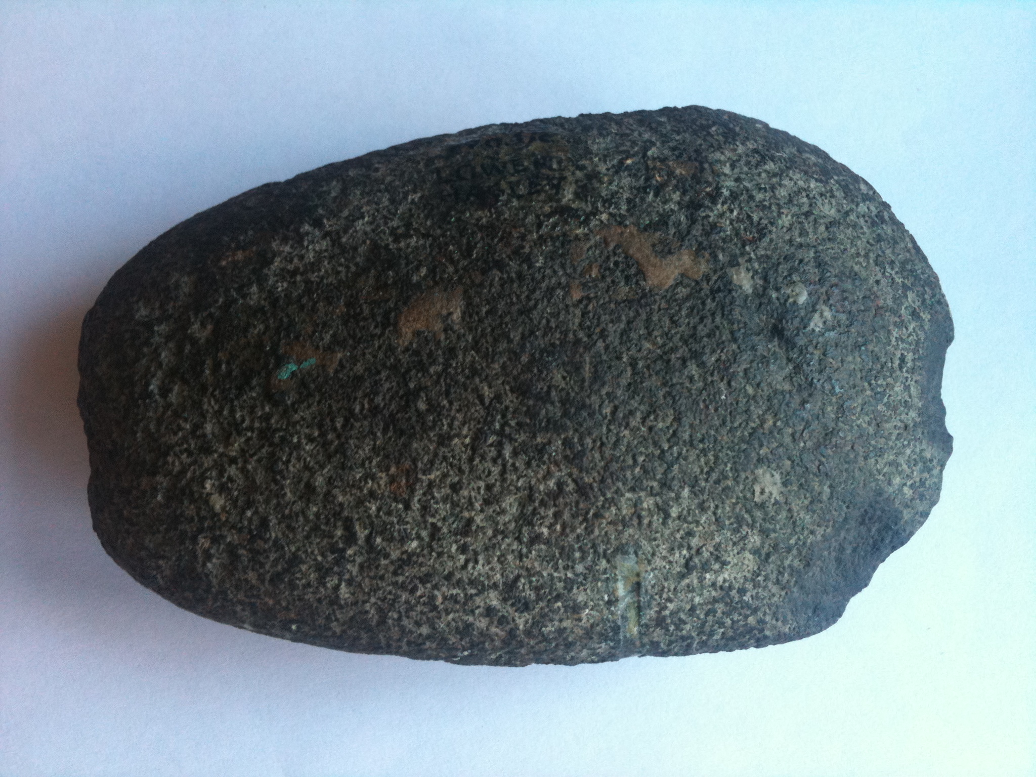
In the next period, the Neolithic, the technology was still based on flint, stone, bone and wooden tools. A range of flints and an axe head have been found, ranging from the Wassell Grove area down to fields near Brakemill Farm. The axe head was found near what is now the village car park in 1892 and is stored in Worcester City Museum. These sporadic finds indicate that Neolithic man was around in this part of the world, but whether or not there were settlements nearby it is impossible to establish.
The Bronze Age people developed metal working, based firstly on copper but soon alloying it with tin to obtain bronze, which could be cast and forged. As we have already said, the basic activity was still arable and animal farming, which meant settlements and the associated burial of the dead. Throughout most of the time that man has lived in Britain, dwellings have been made of materials that were easily obtained in the locality. In the West Midlands, timber would have been used but in areas that have an acidic soil, any traces of wood will disappear. Therefore the most likely evidence for occupation will be burials. For the Bronze Age, burial could be either inhumation or cremation and, as today, it is a question of both geography and fashion.
Locally there were five burial mounds in the field bounded by Stakenbridge Lane on the north, the A456 on the south east and the extension of Broome Lane to the west (see the Parish map in ‘Introduction’). In the History of Worcestershire², written by the Dr.T.Nash late in the 18th century, he describes how he had one mound opened up and that two others were subsequently opened. This brief description gives us some sort of a lead.
The depth at which the ashes, bone and burnt wood were found at the centre of the three mounds indicates their height and from the height an estimate can be made of the diameters.
One mound remains in the hedge on the south side of Stakenbridge Lane and is some 2m high and 10-12m in diameter. Another one is marked on the 1902 edition 25” O.S. map about 50m south of the hedge and the writer observed a red sandy ring approximately 10m diameter x 1m wide when the field was newly ploughed. This does not prove that all five barrows had ditches but at least one did. The fact that no bodies were found and that all the remains are cremations without any grave goods, suggests dates of 1400-1000 BC One coarse urn, well above the ground level, indicates that it was a secondary burial; the primary one would be expected to be at ground level. Finding only one peripheral burial is perhaps surprising but, bearing in mind that the method of “excavation” was to dig at the centre in the quest of treasure, then the level of surprise diminishes.
Logically the associated settlement would be found some 500m, north or north west of the barrow cemetery, adjacent to the brook, but no evidence has been found so far.
The final pre-history period, known as the Iron Age, is represented by Wychbury Hill fort.
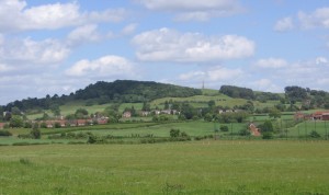
Wychbury Hill from the west. The iron age hill fort is mainly covered by trees in the centre. Hagley monument is seen on the skyline and the park begins on the right hand side of the photograph.
Hill forts³, so called because of their defensive banks and ditches, are now considered to have other uses as well as the obvious. These additional uses may have been concurrent or have occurred at different periods during the overall use of the site.
Hill forts occur mainly in a band from Kent along the southern counties to the east Devon border and up to the south side of the Thames valley. It then turns north up the Severn valley and the Welsh marches to Angelsey and the Dee estuary.
Only a small number of hill forts have been systematically examined in recent years to assess the development of the defences, the use of the interior and the place of the hill fort in the wider landscape. Examples are Crickley Hill, Gloucestershire, Croft Ambrey, Herefordshire and Danebury, Hampshire.
This comparatively recent work shows that defensive banks varied from simple palisades to re-vetted ramparts, plus timber walls and finally to glacis or dump ramparts. Some sites have evidence of occupation for 600 years or even longer, while many were abandoned half way through the Iron Age.
Another defensive feature that was modified with time, was the entrance to the fort. These could be one or more and initially, they were a simple gate across a break in the rampart. This developed into an approach designed so that the enemy could be attacked from two sides as they approached the gates. It could be a simple overlap of the ramparts, or the ramparts could be turned inwards for 10-15m.
Many sites have evidence for buildings, both round and rectangular, for occupation by people and also indicate that considerable areas were given over to grain storage. Depending on the difficulty of digging or, alternatively, the availability of timber, grain could be stored in pits or in small square buildings with a raised floor, usually referred to as four-posters. Some unexplained features are attributed to ritual or ceremonial activities. These ideas are very difficult to prove, but it is a natural thing for humans to give credit to supernatural forces for the success or failure of crops etc., and to take steps to please these forces in whatever way the custom of the time dictates.
Wychbury Hill fort is roughly diamond shaped, some 250m (E-W) and 150m (N-S), with an area inside the ramparts of 3.16ha (7.8 acres). There is a single rampart on the north side, where the natural slope is steep enough to dissuade an enemy. On the south and west there are two, and for a short run, three, ramparts and ditches. The entrances on the east and west extremities are both inturned with some evidence of stone in the construction.
The ramparts are of the glacis or dump structure, which was the final style evolved by the Iron Age people c200-100 BC This only indicates a later date for construction and does not rule out earlier types of rampart. Only careful excavation would clarify this point.
Dating from the present evidence is very difficult. Either a number of artifacts need to be found with characteristics that would allow specialist archaeologists to establish a time band, or, alternatively, if other suitable finds that lent themselves to the radiocarbon dating process could be recovered, accurate dates would be known.
The only finds known are a bronze terret (a ring which reins passed through, used to control a horse drawn, wheeled vehicle) and a small ring, also in bronze. Both were found by E.B.Marten in 1884 and published in Pedmore Parish Magazine in 1887. The information was republished by M.C. Spratling in the Transactions of the Worcestershire Archaeology Society in 1976. Spratling considers these finds date from the second or the early first century BC
It is very probable that metal detectors in recent times have found other items but none have found their way into responsible hands for assessment.
It has already been noted that only a handful of hill forts have been examined in a wider landscape. Where this has been done the forts are seen as defensive in times of crisis; administrative centres for the surrounding area, which would have been farmed from a number of settlements; and storage sites for grain. Whether this last use was related to a form of taxation or as a means of security for the crop, or perhaps a mixture of the two is open to debate.
It is believed that as the use of land became more intensive, then the need to look after both the people and their crops became more important. Therefore the need for adequate defended sites also increased. Changes took place in the first century BC and especially in southern Britain, something approaching urban centres developed and the decline of hill forts began, although it was well into the first century following the Roman invasion that they ceased to be used for any of their former purposes.
No evidence has been found for any settlements, but this is not surprising. Wooden structures in soil that has been well cultivated for many centuries leave very little for archaeologists to assess.
1 T.Darvill. Pre-historic Britain pp. 39-43
2 T.Nash. History of Worcestershire Vol. I pp. 485-6
3 J.V.S.Megaw & D.D.A.Simpson. Intro.to Brit.Pre-history p.355 et seq.


